
Portland Botanical Gardens (PBG) has researched available public material and worked with its consultants and design team to better understand the site history and existing conditions.
The following text is an excerpt from an article in Pacific Horticulture which tells the McCormick & Baxter site story and how this unique site context informs PBG’s proposal.
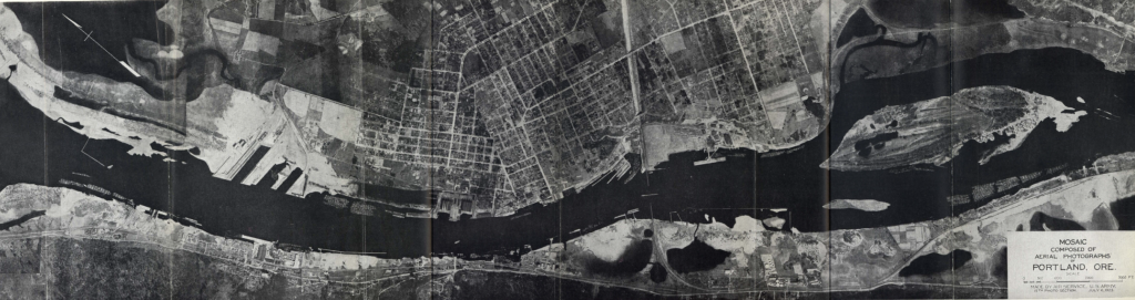
A Botanical Garden on the Lower Willamette River
Formed during the Missoula floods of the last ice age, the Lower Willamette River is a deep, tidally-influenced estuary of high ecological productivity. Although the channel has less room to migrate between the West Hills and Overlook Bluffs, its banks were historically a dynamic mosaic of sandy beach, wetland, prairie, riparian forest, and backwater slough.
The lower Willamette River is the ancestral land of numerous Native peoples, including the “Multnomah, Kathlamet, Clackamas, Cowlitz, Tualatin Kalapuya, Molalla, Chinook, Wasco, and more” (NAYA), and tribes throughout the Columbia Basin traveled to this area to harvest first foods and engage in commerce with one another.
While European contact ushered in an era of epidemics, displacement, and population decline, Indigenous peoples and cultures remain prominent in the Portland region. Today, Portland is home to one of the largest Native American populations in the United States, and tribal communities from across the Pacific Northwest continue to visit, steward, and honor the Lower Willamette River and its resources.
In the late-nineteenth century, the California Gold Rush increased demand for building materials, incentivizing timber harvesting in Oregon. The industrial Portland Harbor gradually transformed the landscape, replacing the marshes and beaches with factories and port infrastructure on the Lower Willamette.
Our proposed garden is located at the McCormick & Baxter Superfund Site—a former creosote wood-treating facility (1944–1991) on the east bank of the Willamette River.
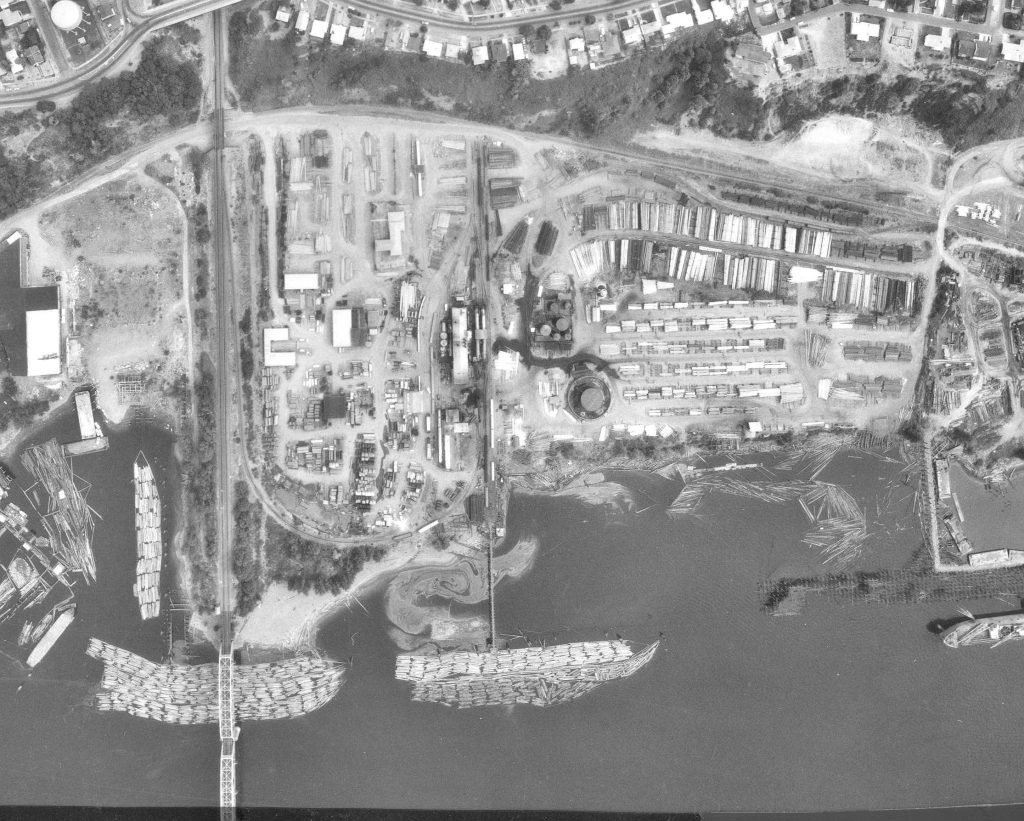
A Botanical Garden at the McCormick & Baxter Superfund Site
Historically a wetland and backwater slough, McCormick & Baxter was filled with sand in the 1920s for use as a lumber mill. In the 1980s, site investigations confirmed releases of wood-treating chemical compounds to soils, groundwater, and sediments, as well as two non-aqueous phase liquid (NAPL) plumes migrating to the river and surrounding properties. After exhausting their insurance coverage, the creosoting company went bankrupt in 1991, and the site received Superfund designation in 1994.
Superfund is formally known as the Comprehensive Environmental Response, Compensation, and Liability Act (CERCLA), which Congress enacted in 1980 to allow the Environmental Protection Agency to assess potentially contaminated sites, connect with responsible parties, and oversee cleanup. CERCLA also provides funding to remediate “abandoned or uncontrolled hazardous waste sites.” (EPA 2025).
Portland Harbor received its own Superfund designation in 2000, covering a 10-mile stretch of river and including over 150 potentially responsible parties. After 25 years, remedial design is ongoing. Although the Portland Harbor Superfund Site surrounds the McCormick & Baxter site, it has a separate cleanup timeline. Meanwhile, McCormick & Baxter is ready for reuse.
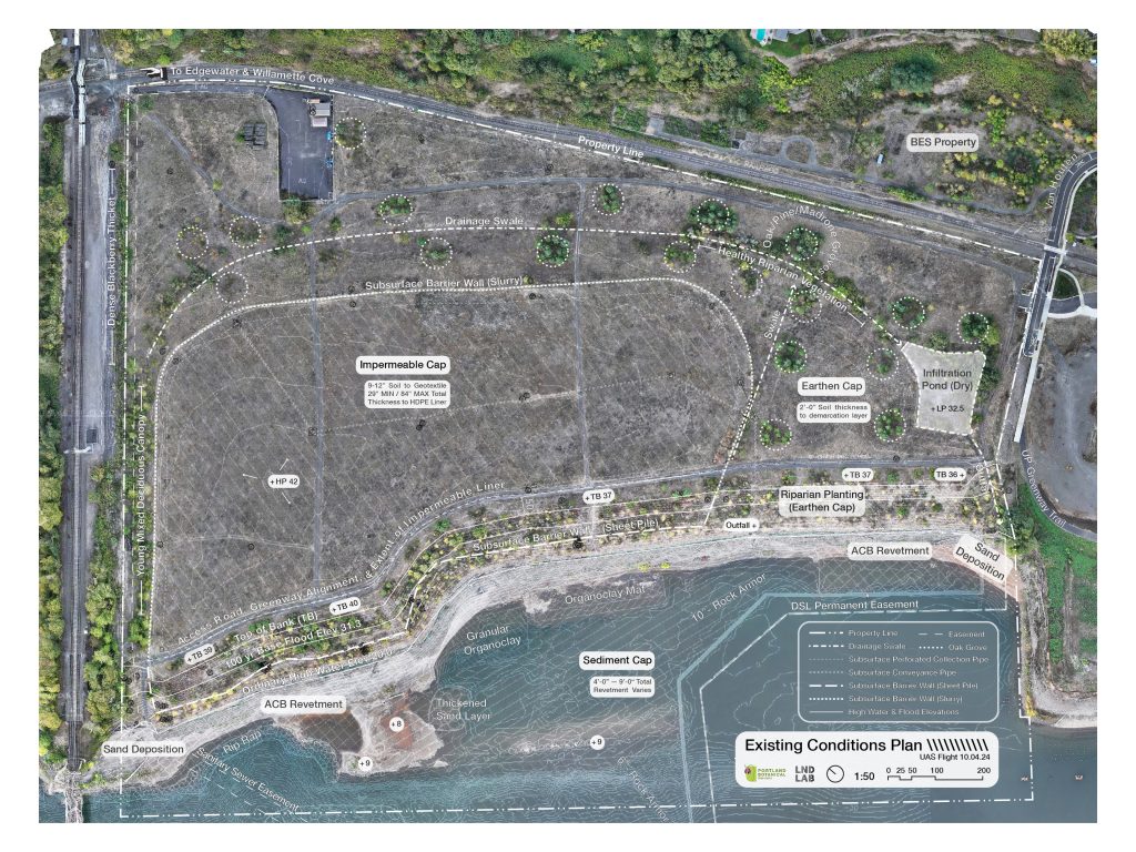
Remedial design and action took place between 1996–2005. The EPA and Oregon Department of Environmental Quality (DEQ) collaborated on remediation, starting by demolishing the manufacturing plant, then excavating, treating, and disposing thousands of yards of soil. They capped approximately 15 acres with an impermeable liner and surrounded by a subsurface barrier wall to prevent surface and ground water intrusion, and covered all land above ordinary high-water level (OHW) with clean soil. The EPA and DEQ also constructed a multi-layer sediment cap in the Willamette River below OHW and extending into the river.
Once the EPA and DEQ completed this remedy, they oversaw a large habitat restoration in 2006 to establish a new riparian forest, oak savanna, dry meadow, and bioswale. This existing plant community is a huge benefit to the proposed garden as it makes up our initial collection and allows research and educational programming to begin in the first year—effectively giving us a 20-year head start. It’s also uniquely valuable since the performance of the restoration helps us better understand the horticultural conditions of the remedy.
Over time, we think that our continued monitoring of the remedy and habitat restoration can provides critical insights for future restoration projects in the Portland Harbor Superfund Site—and climate adaptation for the region in general.
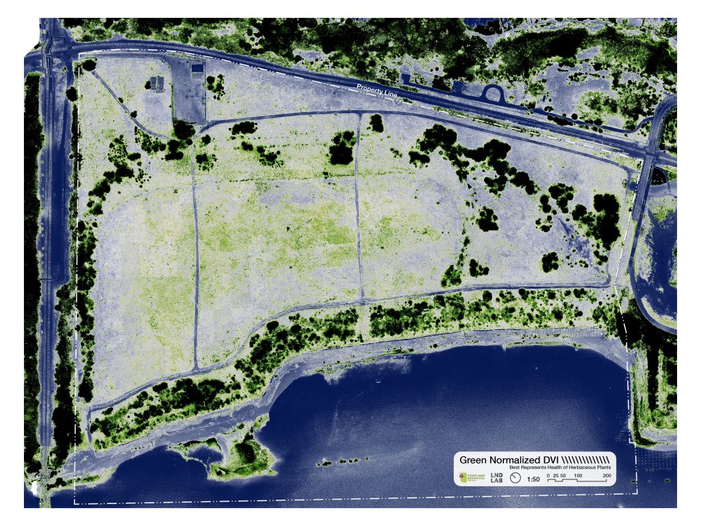
A Botanical Garden in the Willamette Valley Prairie
As part of our due diligence, Portland Botanical Gardens surveyed the site using aerial photography, multi-spectral imagery, and on-the-ground vegetation monitoring to better understand plant health following summer drought (see PBG blog for more details). We found that extreme heat and drought are favoring xeric native species on the site—even in the riparian area. In trying to diagnose this performance, we discovered that the site is drier than most of the metro area, with up to 25” less precipitation than the crest of the West Hills across the river, and is an urban heat island, with evening temperatures up to 12 °F (7 °C) above the city average (SUPR Lab). These climatic conditions are exacerbated by a remedy designed to shed water as quickly as possible.
Historical research also suggests that the east bank of the Lower Willamette has been ecologically distinct even before urbanization. While anthropogenic fill largely makes the 1850 vegetation map (Pope 2013) irrelevant for this particular site, “xeric prairie” is shown on river benches north and south of McCormick & Baxter. Additionally, several species present in the adjacent Overlook Bluffs are at the northernmost extent of their historical range, among them Willamette Valley ponderosa (Pinus ponderosa spp. benthamiana) and buckbrush (Ceanothus cuneatus).
These maps are flawed since Euro-American records discounted the agency of Indigenous cultural practices in shaping the Willamette ecosystem. Also, settler colonialism had already significantly impacted cultural landscapes by 1850, including through seven waves of epidemic disease (smallpox, measles, malaria, influenza, and dysentery). Still, they provide a useful snapshot in time when some level of controlled burning was prevalent.
These factors make the site uniquely suited for researching the role of horticulture in climate change adaptation and urban ecology. After 175 years of fire suppression, the extent of xeric prairie (and savanna) has shrunk to less than 1 percent of historic range. Nearly all the Willamette-adjacent xeric prairie that was documented in 1850 has reforested or been converted to farmland. The unique conditions at McCormick & Baxter provide an opportunity to restore this endangered ecosystem to the Portland Harbor, where tribal nations continue to serve as trustees of our natural resources.
A Botanical Garden in North Portland
Botanical gardens are nonprofits because of the numerous public benefits that they provide through plant conservation, education, scientific research, and public health. For Portland Botanical Gardens to best provide these public benefits and fulfill our vision of a community-serving botanical garden, “due diligence” also means relationship building.
North Portland is one of the most diverse parts of the city—and with that also carries a legacy of environmental injustice. Of the four census tracts immediately surrounding McCormick & Baxter, two are categorized as disadvantaged by the Climate and Economic Justice Screening Tool (Council on Environmental Quality 2022), based on demographic and environmental factors, including: low income, high unemployment, high asthma rate and exposure to diesel particulate, and Superfund proximity. Additionally, these census tracts have some of the highest poverty rates in Portland according to the city’s Office of Community and Civic Life (2024).
Despite being surrounded by water, North Portlanders have limited riverfront access. There are just three river access points in the eight-mile stretch of the Willamette between Swan Island and the Columbia River.
The two-mile stretch encompassing our site has had virtually no economic activity for the last 20 years, yet it remains an urban heat island. By collaboratively planning the proposed garden, this project can transform a place of past industrial harm into a living landscape of cultural renewal, climate resilience, and community pride.
Since beginning the process of acquiring McCormick & Baxter, we have met with hundreds of stakeholders, given dozens of presentations, and led 50 tours of the site with volunteers, donors, and community members. We have also greatly benefited from observing Metro’s engagement process for the Willamette Cove Natural Area (2024) and the Portland Harbor Community Advisory Group’s regular public meetings. From those engagements, as well as feedback gathered through direct outreach to tribal nations, neighbors, and interest-holders, we have been able to refine our vision into a Conceptual Master Plan.
Weaving our dream for a botanical garden with the complexities of a Superfund site and the unique communities of North Portland has taken time—and will require ongoing dialogue and relationship building over the coming years—but we think has also yielded a solid foundation to build upon.
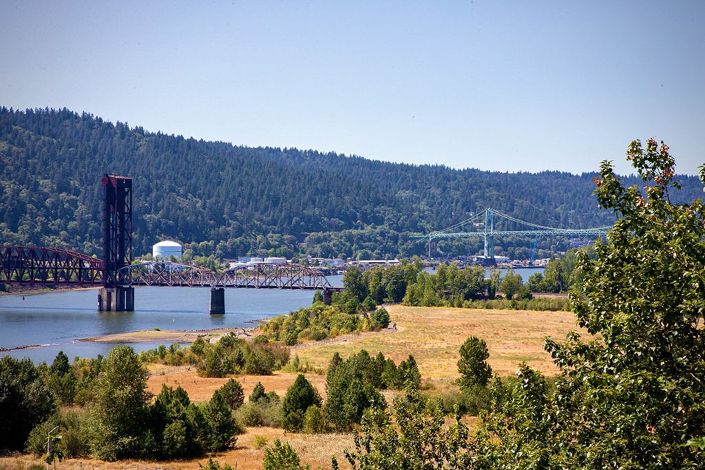
Bird’s eye view over the proposed garden site.
Public Data Sources
Both the Oregon Department of Environmental Quality (DEQ) and Environmental Protection Agency (EPA) maintain excellent public documents webpages on the McCormick & Baxter site, and which provide a rich history of the industrial use and cleanup at the site:
EPA M&B Website
DEQ M&B Website
An excellent starting point in understanding the industrial use and cleanup history is the “M&B Remedy Implementation General Overview” published 12-10-20: